Report Design
Port Master Plan 2050 Executive Summary
Client
Port Authority of New York and New Jersey (via Hatch)
Industry
Government Agency
My Role
Designer
Location
United States of America
The Project
The Port Authority of New York and New Jersey needed an executive summary to communicate its long-term 2050 vision to a broad audience spanning government staff, impacted communities, technical stakeholders, and international audiences.
I was integrated into the New York-based project team as a design resource during a late-stage production phase, helping move the document toward completion while getting up to speed quickly on a complex infrastructure project with significant geographic and operational scope.
The work required clear visual communication, technical accuracy, and careful alignment with the Port Authority’s established brand standards.
The Thinking
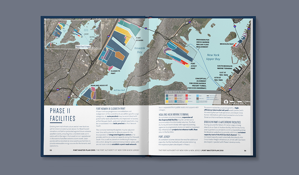
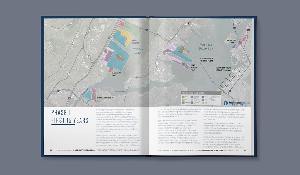
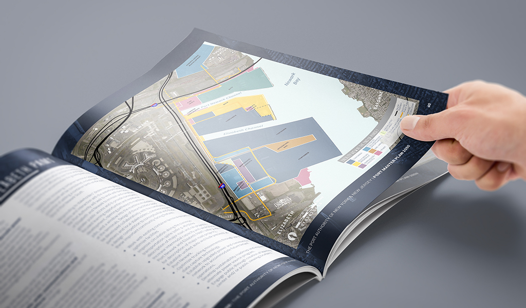
The mapping work was the most technically demanding aspect of the project.
Translating ArcGIS data into brand-aligned, public-facing regional maps required a specialized workflow: exporting geographic data from ArcGIS into Illustrator, then rebuilding the visual layer so the maps could meet both the document’s design standards and the audience’s comprehension needs.
Geographic data at this scale carries a significant amount of visual noise. Roads, boundaries, waterways, terminals, routes, and surrounding context all compete for attention if they are treated with equal weight. The design process required editorial judgement: deciding what to show, what to simplify, and what to remove so the relevant information could be understood quickly.
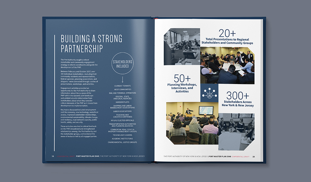
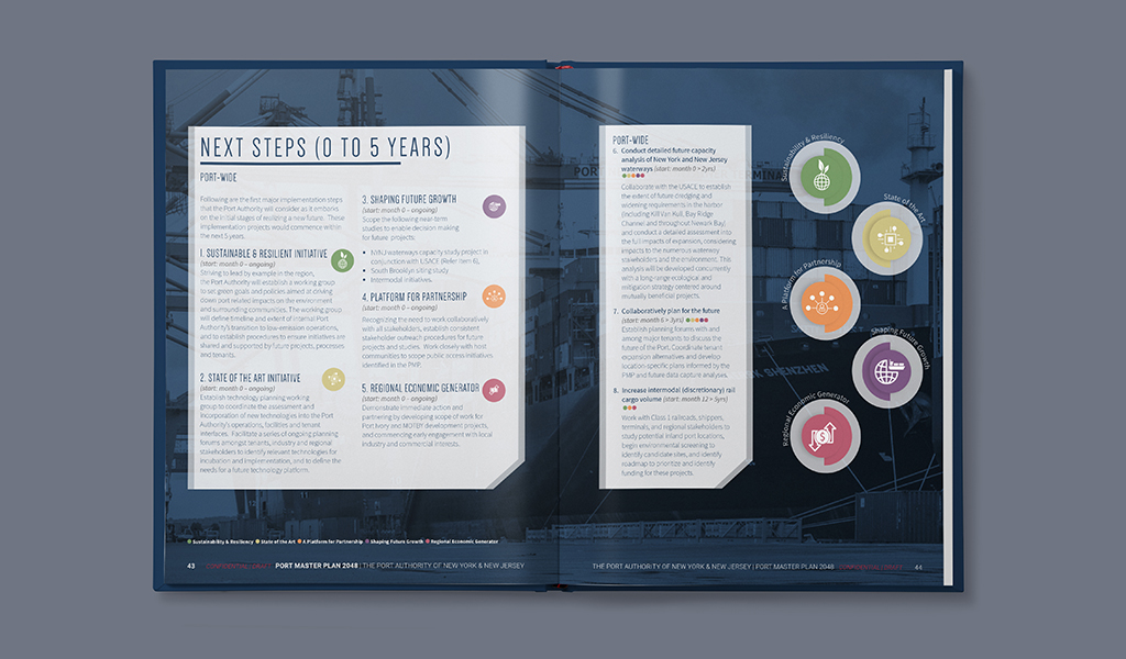
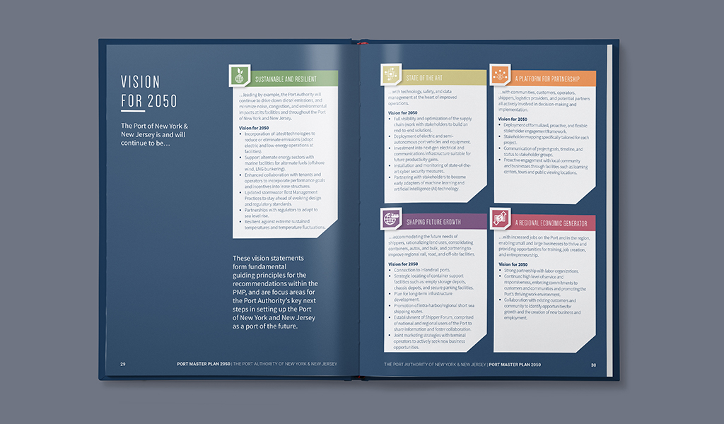
Custom iconography and infographics were developed to clarify the plan’s strategic goals and future impacts. The goal was to make a complex long-term infrastructure vision easier to understand for non-specialist readers while preserving the credibility and precision expected by technical and institutional stakeholders.
What This Demonstrates